
stone corral
Beginning near Kinuseo Falls, the Stone Corral trail has been a popular destination since its discovery in 1999. This geosite resides inside Monkman Provincial Park and along with Nesbitt’s Knee Falls, Barbour Falls and Foehn Wall can make the drive to Kinuseo Falls into a full day or overnight excursion. There are many stops at this geosite so be sure to stop by our Visitor Information Centre to find out more detailed information.
Distance | Time:
3 km return | 2-3 hours
Elevation Gain: 230 m
Trail Rating:
Moderate

Features:
Karst, geology, caves, interpretive brochure.
-

Trails
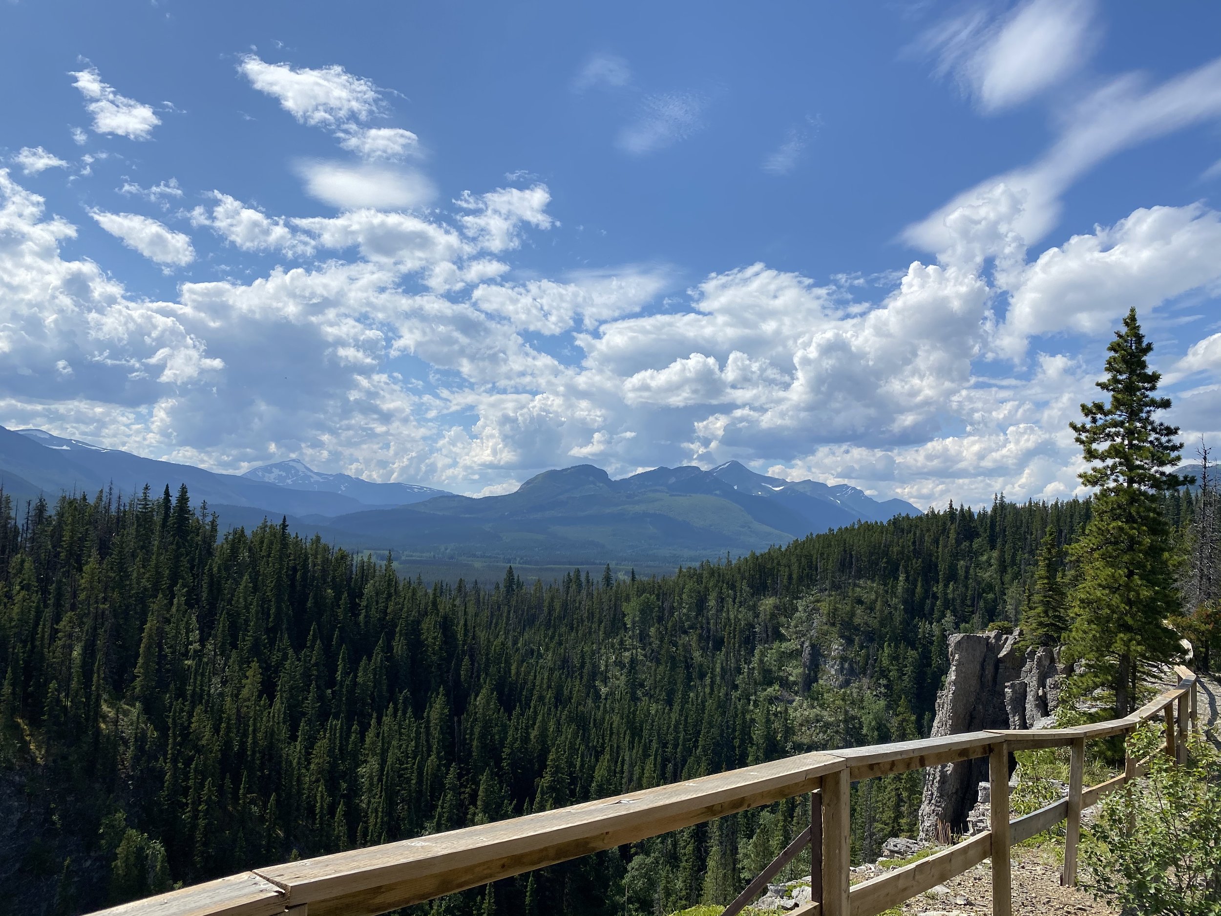
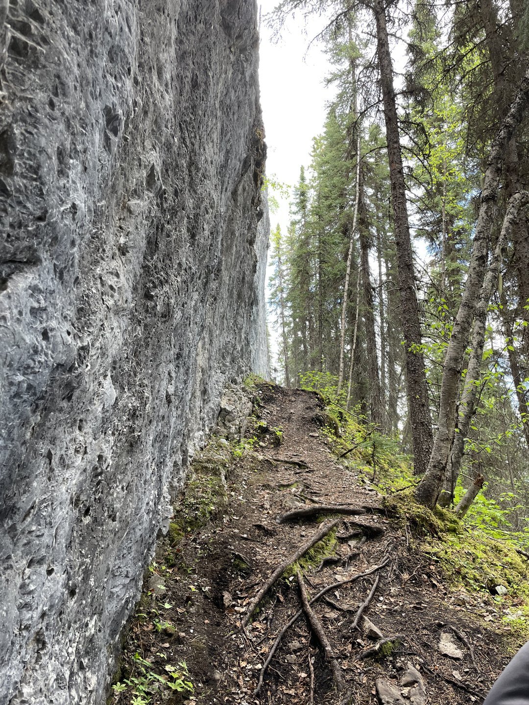
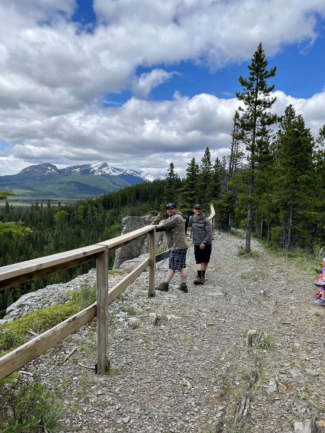
The trail is classified as moderate and includes both steep sections and significant changes in elevation. Several tall cliffs are present along the trail. It is important to exercise caution near the edges of these cliffs, especially when children are present. To ensure safety, it is advised to maintain a high level of noise while hiking, as black and grizzly bears are frequently found in this region.
-

History
In 1999, a team of cavers from Tumbler Ridge consisting of Charles Helm, Daniel Helm, Al Tattersall, and Lindsey Tattersall discovered the Stone Corral. Subsequently, this area was included in Monkman Provincial Park. The trail development was a collaborative effort involving two E-teams, along with the Ministry of Environment Lands and Parks, BC Parks, the Wolverine Nordic & Mountain Society, and Tumbler Ridge Youth Services.
-

Geology
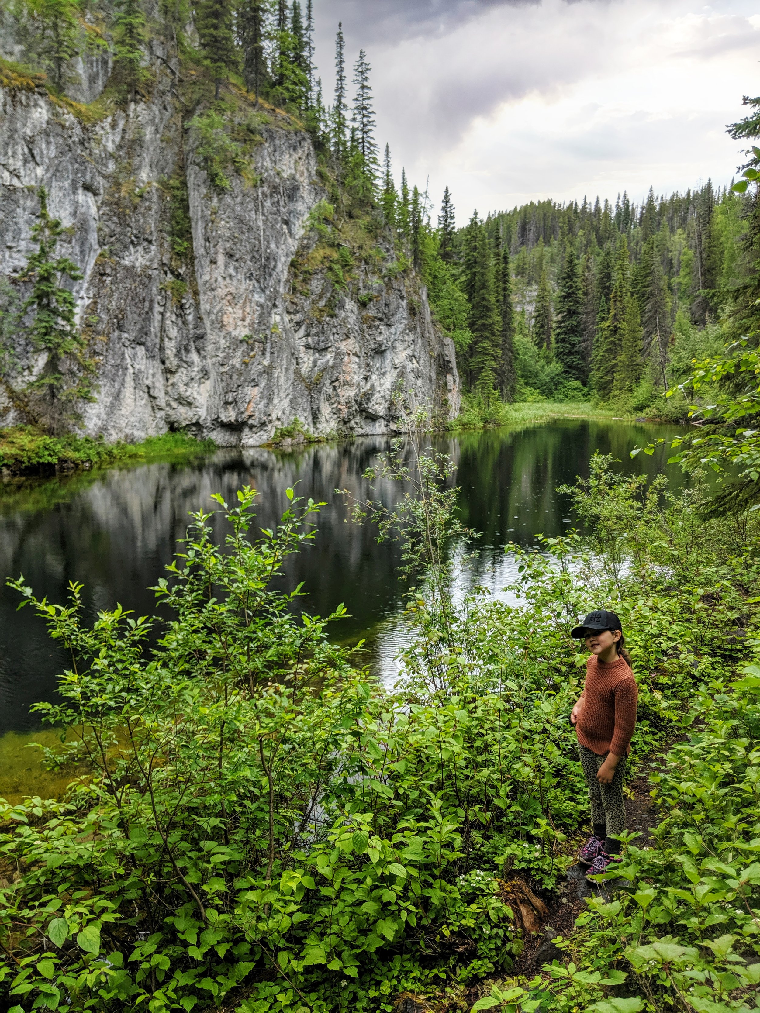
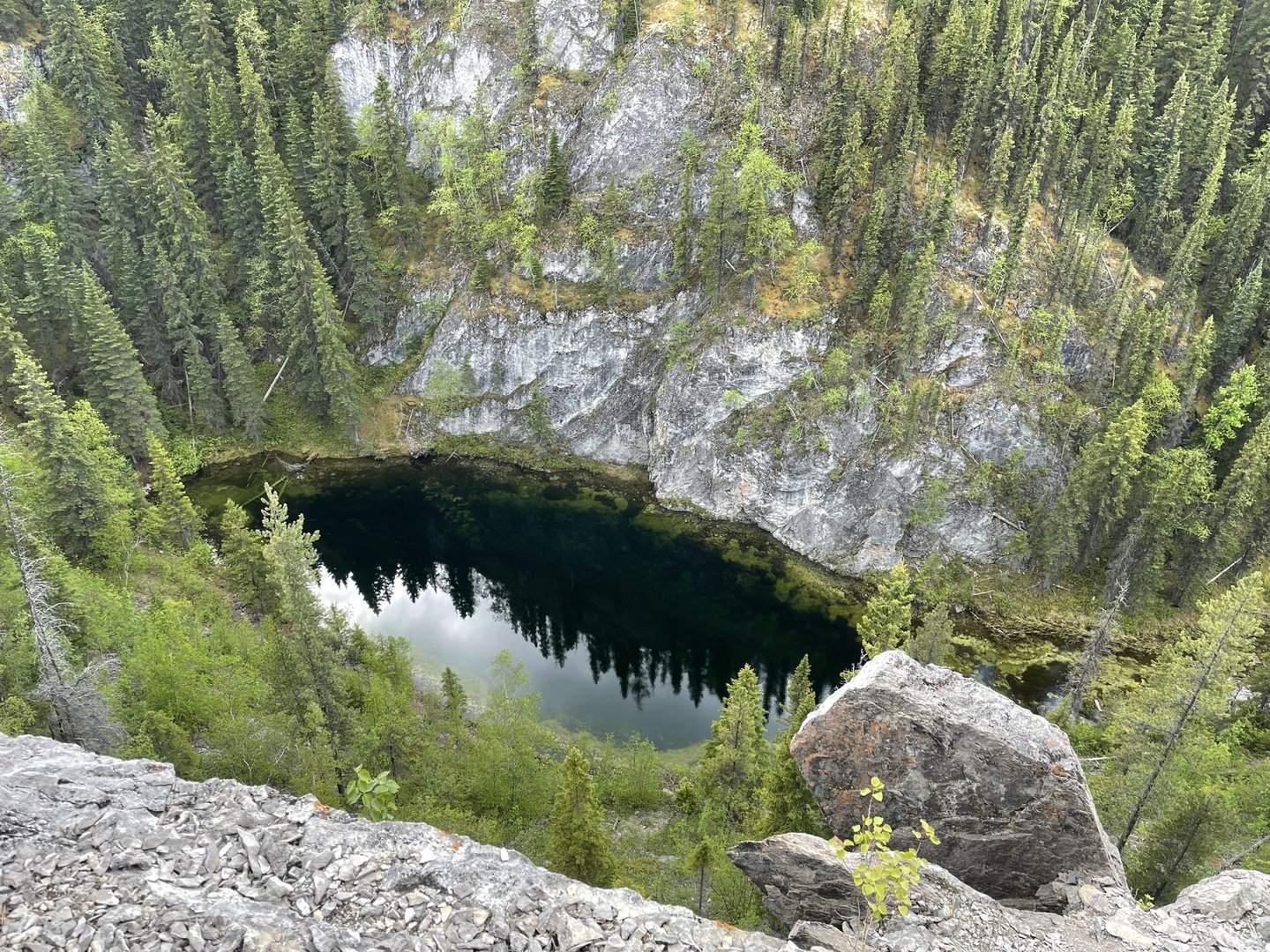
The bedrock in the vicinity of the trailhead consists of siltstone originating from the Sulphur Mountain Formation, dating back to the early Triassic period, approximately 250 million years ago. Along the trail, there is a noticeable shift towards rocks from the Rundle Group, which can be traced back to the Mississippian age, around 340 million years ago. In other parts of the world, rocks from this era often contain the fossilized remnants of vast forests and serve as significant sources of coal. However, in this particular region, these rocks were formed in warm shallow seas, resembling the present-day Caribbean. Over time, these deposits transformed into limestone, which was subsequently dissolved by mildly acidic groundwater, resulting in the creation of a karst landscape characterized by caves and sinkholes.
-

Trip Link
The Stone Corral is located in Monkman Provincial Park. There are numerous options for trip links including Nesbitt’s Knee Falls, Barbour Falls, Lake Joan and Canary Falls, and Kinuseo Falls.
-

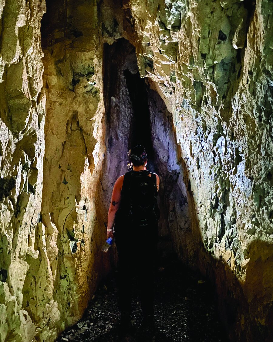
Caves
Corral Cave is the largest and resides just up the slope from the Corral pond. Please watch your head as this high cave does have some low spots.
Further up the hill Porcupine Cave offers those who brought their flashlights and interesting experience. Be sure the enter via the 2nd entrance on the path. A real treat for kids!
-

Caution
The trail is strenuous with some steep sections and considerable elevation change. There are a number of high vertical cliffs: a fall would likely be fatal! The trail passes close to cliff edges, and children will require close supervision.
This trail is in bear country. Travel in groups and make noise.
DIRECTIONS TO TRAILHEAD
The trailhead parking lot is shared with the Lake Joan and Canary Falls trail. To reach it, drive towards Kinuseo Falls on Hwy 52 E. Turn right 14 km from Tumbler Ridge onto the Kinuseo Falls Road. The end of pavement is reached at km 3, and at km 9, after the road crosses the Murray River, there is a junction. Continue left, staying on the Kinuseo Falls Road until km 48. The parking lot is on the left, soon after entering Monkman Provincial Park (62 km from Tumbler Ridge).

thank you to our partners

experience tumbler ridge unfiltered. tag #tumblerridge to show us your adventures.